When I was introduced to a research project that utilizes Unmanned Aerial Vehicles (UAV) in 2014, i have imagined first: “military missile equipped aerial vehicles”. And i was kind of nervous to join such a research area as being a civil engineering graduate. Because i was not familiar with UAVs and they were not so popular in those years. Although it was a new era for me, i decided to join the research team as a GIS researcher. After a bit painful and trial-and-error beginning step, we learned the fundamentals of aerial vehicles and we discovered how to use them for the purpose of our project. Eventually, we accomplished the project –Cankuş (Life saving birds)- needs and dived into the area of the aerial imaging 4 years ago.
After the end of the project, we wanted to implement drone-based applications in various civil engineering fields. Because we realized the potential. In my master program, we developed an automated pavement crack identification system using drones. In 2017, we have launched one of the our finest project SiteEye for the purpose of construction monitoring techniques in which drones are a part of it. Currently, we are working on it. But rather than sharing our drone projects, i would like to share my ideas about drone usage.
Life is about seeing. Without seeing it is difficult to understand and believe in something. We can better express our thoughts using figures instead of few words. We refresh our memories while we are looking old printed photos. Therefore, saving first step of a baby, a smile, a sadness, a hope is possible taking the photo of that scene. Until now, we were doing them via our cameras or smart phones and we were on the ground. Now we have flying cameras which we simply call drones. As I mentioned before, the “drone” itself was a scary word in the past, because of military made vehicles. But things change. Nowadays, drones become toys of our children. They are cheaper and easier to use.
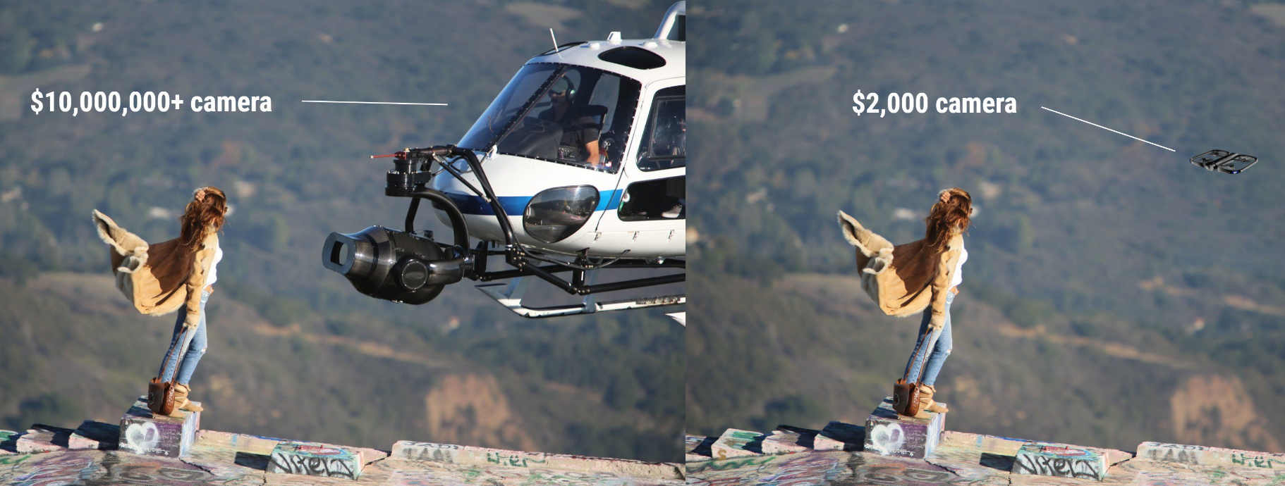
People quickly got used to drones. They have started to carry mini-drones while travelling and posted drone selfies into Instagram. Higher reputation of the aerial imaging was continued until drones were employed as wedding ceremony recorders. If you google “havadan çekim” (aerial imaging) keywords today, you may see thousands of services who use drones as an imaging tool in any purposes. Although “military drones” became “wedding drones”, these events enlightened one thing to us: Aerial imaging is on the stage now.
Rather than hobby-purposed drones, they are helping to solve many industry problems. Cheaper aerial imaging enabled to perform computer vision algorithms for many practical applications. From structural inspection to agriculture, manual processes now leaves their stages to automated systems. Therefore, no matter which sector you are working on, ask this question to yourself: “Is aerial view of any kind of your product/process improves your work and helps you to understand it better?” If the answer “yes”, start searching on drone capabilities.
Best,
ABE.